
SatcatSatcat
A comprehensive space object data aggregation and intelligence exchange platform designed for everyone–from satellite operators to space professionals, to students and enthusiasts.

Satcat is the industry-leading spaceflight intelligence exchange that aggregates real-time and historical data for objects and events in Earth’s orbit.
Information about events surrounding the Earth should be easily accessible to everyone, in one place. Designed to be a resource for users ranging from space-curious individuals to industry experts, Satcat offers users a streamlined way to easily search, reference, and analyze information relating to objects and activities in Earth’s orbit.
Solutions
Satcat Operations
Satcat Operations provides the industry-first combined flight dynamics and space traffic coordination services under one unified platform. Satellite operators can receive precise tracking of their assets and secondary objects and can autonomously coordinate maneuver responsibility and conjunction event mitigation status at the machine-to-machine level. These coordinations are done in accordance with user preferences, industry best practices, and the rules of the road already endorsed by dozens of satellite operators and space companies.
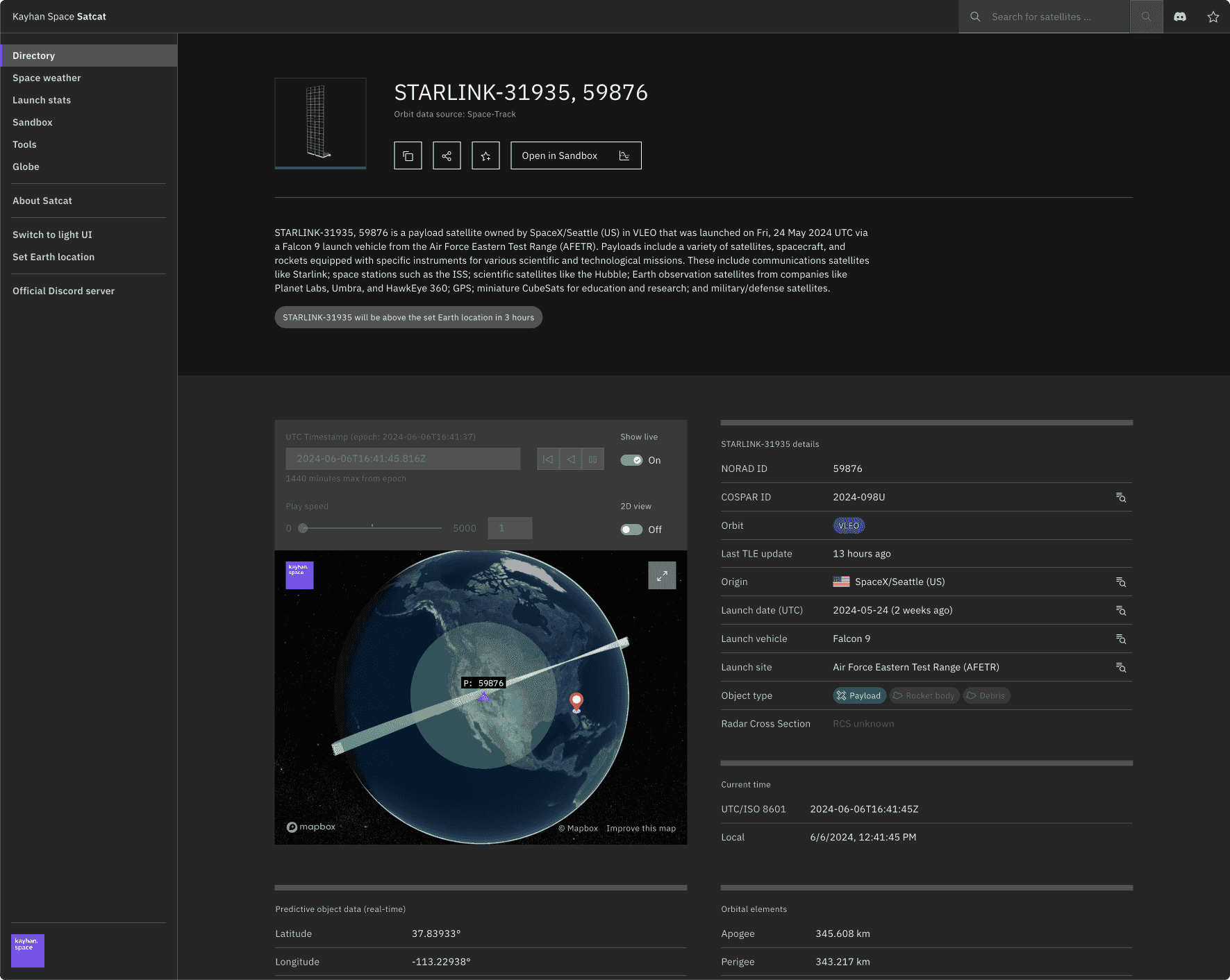
Satcat Directory
Satcat Directory, the largest repository of space object information, enables advanced searches by various parameters, streamlining research on active and decayed objects in orbit.
Satcat Simulation
Satcat Simulation provides hands-on operations training with real-world scenarios by interacting with its interactive tools, such as simulated constellations, orbital datasets, and mission analysis tools. Students, space professionals, and enthusiasts can utilize this capability to enhance their knowledge of constellation design, orbital mechanics, and spaceflight safety.
Satcat Intelligence
Our AI-powered space domain awareness capability, Satcat Intelligence, detects threats, predicts orbital behavior, and analyzes satellite activity. This system provides real-time alerts on detected maneuvers or anomalies, enabling proactive decision-making. With a customizable watch list and advanced pattern-of-life analysis, Satcat Intelligence helps safeguard space assets with precision.
Satcat LEOP
Satcat LEOP ensures satellite deployment and early operations run smoothly and safely with precise orbit data, rideshare visualization, and real-time conjunction risk screening.
Satcat Launch
Satcat Launch detects potential collisions between a launch vehicle and the RSO in record time, completing the process in under one minute. It actively notifies operators of upcoming high-risk events and generates an in-depth conjunction analysis report with safe and unsafe launch windows of opportunity.
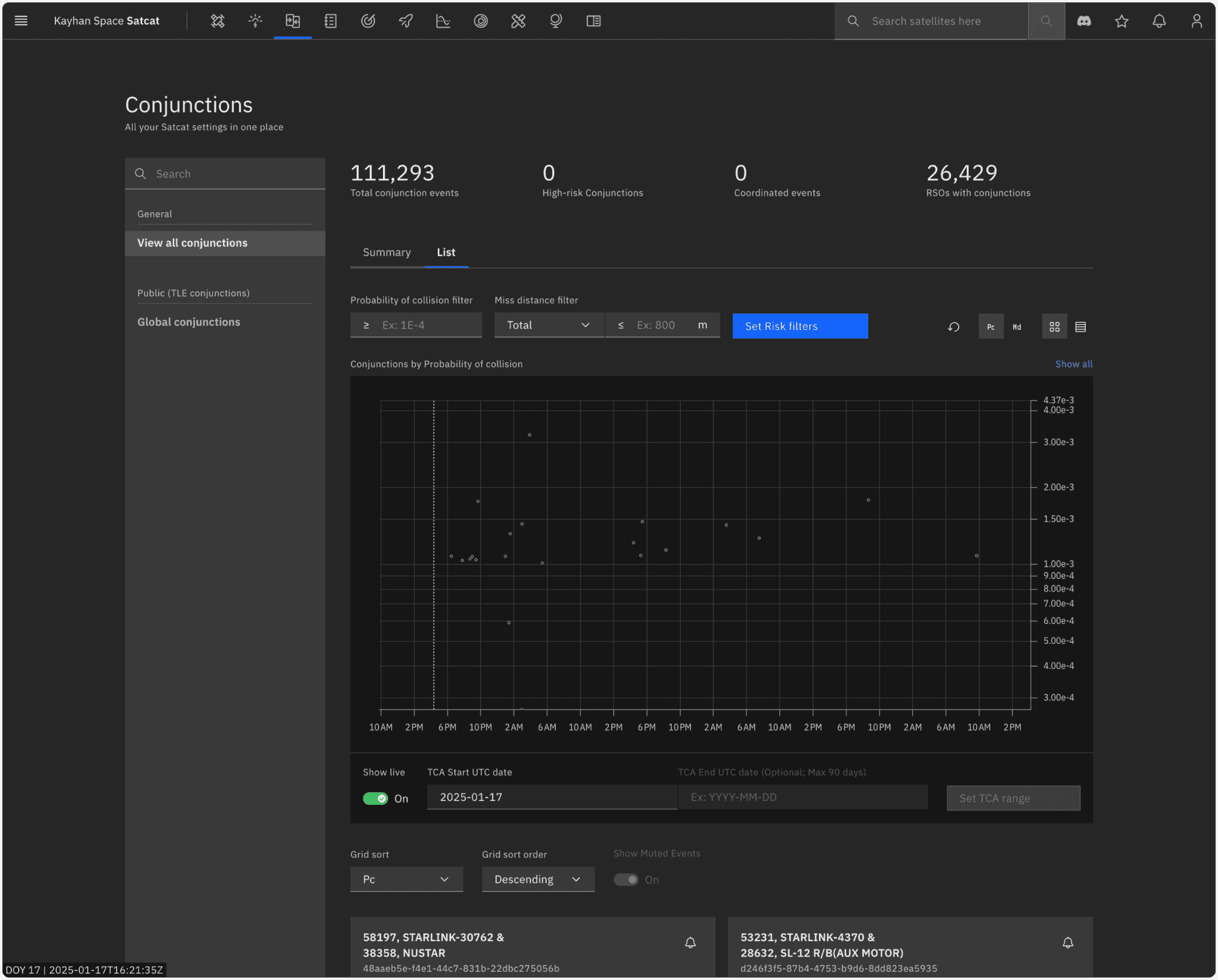
Conjunctions offer daily catalog vs. catalog screening results of conjunctions between RSOs using Two-Line Element (TLE) data. This tool is in addition to the more precise conjunction assessment service that is provided to satellite operators using precise non-public ephemerides offered under Satcat Operations.
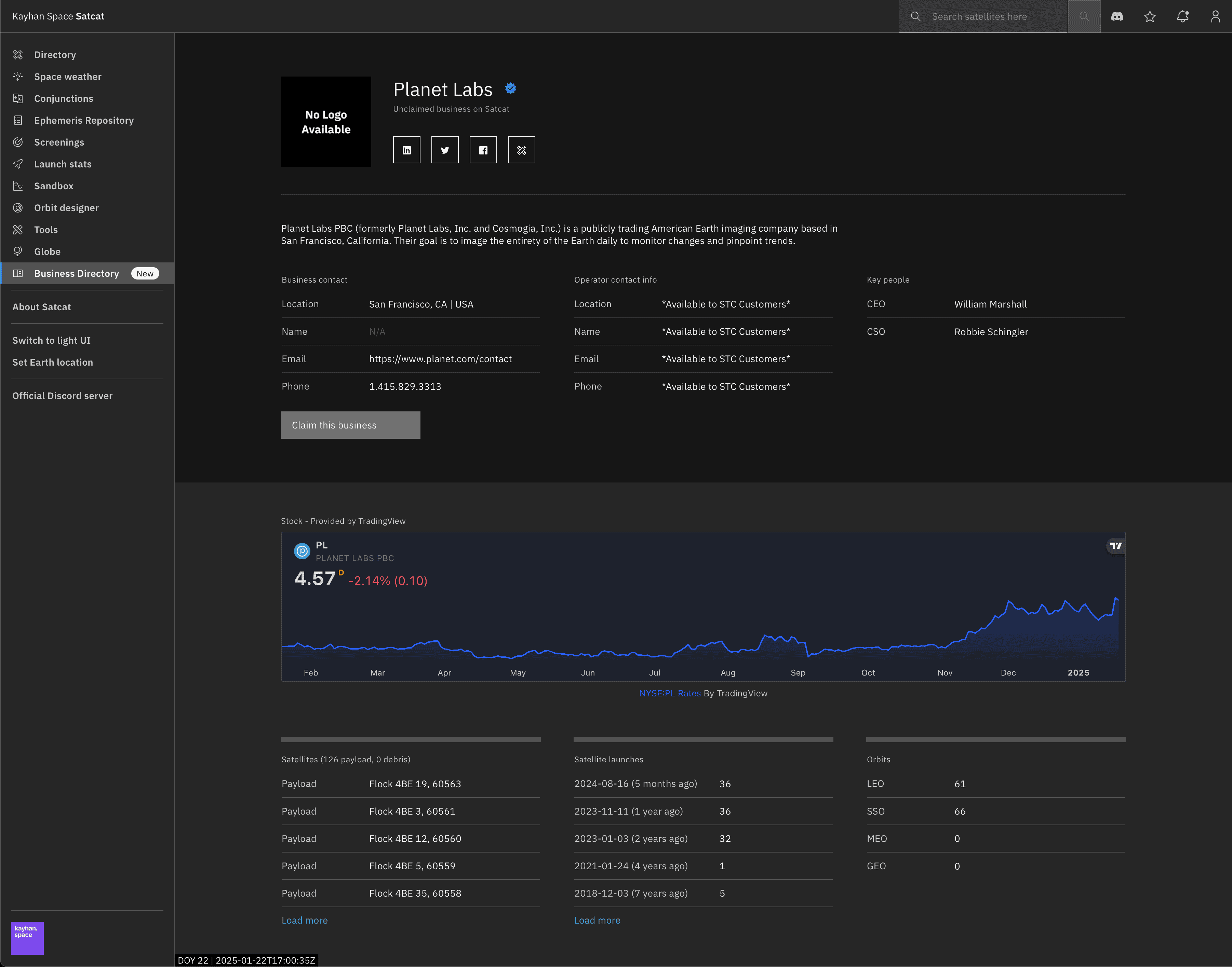
Business Directory enhances ownership transparency by providing verified, up-to-date information on satellite owners and operators. This tool boosts visibility for users while enabling networking opportunities, helping them connect with potential partners, clients, and industry stakeholders.
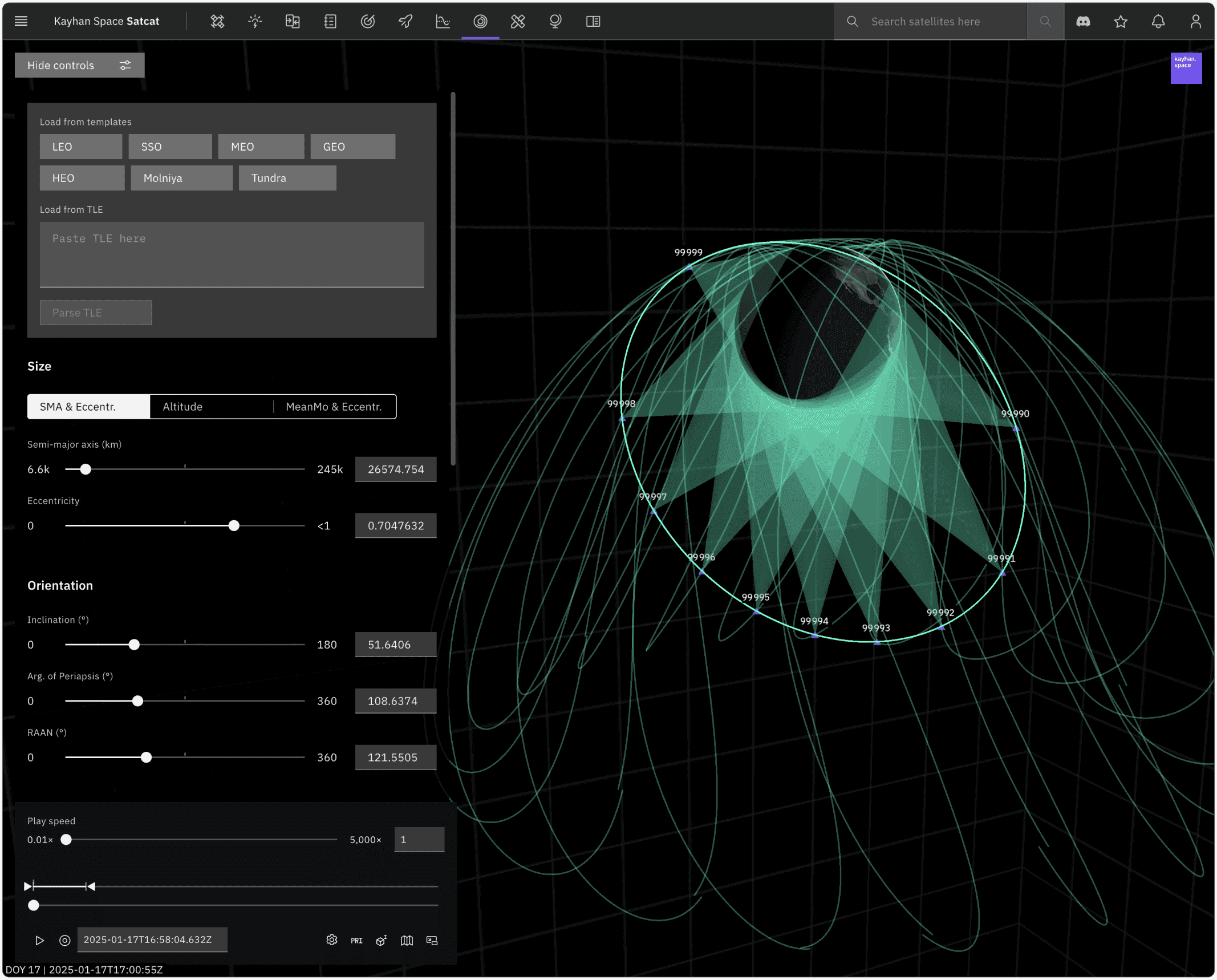
The Orbit Designer tool makes exploring satellite behavior and orbital mechanics intuitive and engaging. Design precise orbital configurations across LEO, GEO, Molniya, and SSO, adjusting key parameters to simulate real-world dynamics. With 2D and 3D visualizations, analyze trajectories from multiple reference frames for deeper spatial insights.
Satcat Operations Service Tiers
| Essentials | Pro | Enterprise | |
|---|---|---|---|
| Operator SSA directory | |||
| Autonomous space traffic coordination | |||
| Additional Pc and validation metrics | |||
| Government and operator SSA catalog data | |||
| Additional third-party SSA catalog data | |||
| On-demand & scheduled catalog screening | |||
| Basic avoidance maneuver recommendations | |||
| AI assistant | |||
| Historical CDM access | |||
| CDM Event History (2 weeks) | |||
| CDM Event History (Unlimited) | |||
| LEOP Essentials services | |||
| LEOP Pro services (including LEOP Essentials) | |||
| On-demand asset & debris tracking | |||
| Covariance realism & sensor calibration | |||
| Flight dynamics systems integration support | |||
| Operational orbit determination | |||
| Optimal avoidance maneuver recommendations | |||
| Orbit maintenance maneuver design | |||
| Custom astrodynamics analysis | |||
| On-call SME support |
Satcat Operations Pricing
| Tier type | Price (*: Additional conditions apply with no extra cost.) |
|---|---|
| Essentials | Free of charge |
| Pro (up to 3 satellites) | $1,900* per month |
| Pro (up to 5 satellites) | $2,500* per month |
| Pro (5+ satellites) | Contact us |
| Enterprise | Contact us |